I learn a few things about a friend and myself and finally figure out how I want to start spending more of my time.
I was invited by a friend to spend about four days with him out at a home he owns with his sister in Lopez Island. Lopez is one of the San Juan Islands between northwestern Washington State and Vancouver Island in Canada. It’s small and not very popular with tourists, who seem to prefer the resort atmosphere on San Juan Island (Friday Harbor and Roche Harbor) and Orca Island over Lopez’s mostly rural feel.
My Previous Lopez Trip
I’d spent about a week out at my friend’s place back in the autumn of 2014. I was still pretty raw from the ordeal of my crazy divorce. My idiot wasband’s appeal of the judge’s decision was dragging on (and on). He was going after my business assets and refused to pay me the $100K+ he owed me for my half of our marital home. My building shell was done but I was still living in my big fifth wheel RV, unable to complete construction of my living space without an inflow of cash. A vacation with an interesting man I really liked was something I needed.
I’d been introduced to my host earlier in the year when he and his sister had driven through California. I was based there with my helicopter on a frost contract. They wound up spending the night with me in my RV and we went wine tasting in Napa Valley the next day. We also took a nice helicopter tour over the valley, where we got to watch balloons launch into the patchy fog. Later in the year, he and I had gone wine tasting in Woodinville. He was knowledgeable about wine and had similar tastes to mine. Conversation was easy and we agreed on many things.
So when he invited me to spend some time with him at Lopez after cherry season, I was all over it. I flew out with my helicopter, which was probably a mistake — it caused me to delay my departure and I stayed a bit longer than I should have. Although I think we both had a good time at the beginning of my stay, I think he took his role as host too seriously and didn’t do things that he wanted to do without company. At the same time, I’m the kind of person who needs alone time and didn’t get as much as I wanted. So by the end of my stay, we were both ready for me to leave.
I went wine tasting with him the following year. I also helped him, on several occasions, find apples and even juice for his side business as a hard cider maker. But beyond that, we didn’t communicate much.
So imagine my surprise when he invited me to join him again at Lopez this year.
Edmonds Prelude
The invitation came in the spring but I had to delay my visit until after cherry season and a few other trips I had scheduled, like my trip to Oregon to see the eclipse. There was a lot of uncertainty about dates, too. He’d lost his job earlier in the year and thought there was a good chance he’d have a new one before my visit. That meant the trip would be limited to a weekend, which is a problem for me. I do most of my tour and event flying on weekends. But as summer went on and no job materialized, we picked a few days in September after an event I’d had on my calendar for a few months. I’d join him in Edmonds on a Sunday to help him sell cider at a Farmer’s Market, then head out to Lopez for three or four days.
I drove. I packed my little Honda S2000 to the gills with clothes, camera, drone, wine, a cooler full of vegetables and frozen rib roast, and Penny. The car was so crowded that Penny had to sit in her bed on top of the cooler on the passenger seat. I put the top down and rolled the windows up, wrapped a scarf around my head to keep my long hair from becoming a tangled mess, and took off on the 3+ hour drive on Saturday afternoon.
I arrived at his house just after he got home from another Farmer’s Market. He greeted me with a warm hug. We went out for dinner at a real Chinese restaurant. Later, back at his house, we chatted until bedtime. Penny and I were comfortable in the guest room.
In the morning, after a shower, we packed up his Subaru for the Sunday Farmer’s Market. We set up early and were able to keep the car parked at the booth. We worked together well with me pulling passersby into the booth and handling sales while he poured tastes and talked up the cider. It started raining right around the time the Seahawks game started and the place cleared out. I bought cheese and corn on the cob and snacks. The rain let up at quitting time and we packed everything, including the wet shelter tent, into his car for the trip back to his house.
I’d brought two racks of St. Louis ribs that I’d smoked on my Traegar on Friday and we ate one of them, finished off with barbecue sauce on his grill, along with some of the corn for dinner. Then we packed up his car again, this time with his travel gear and mine, and headed out to catch the 9 PM ferry to Lopez.
Same Place, Different Vibe
I didn’t realize how far the ferry at Anacortes was from Edmonds. The drive was more than 90 minutes. It was dark and rainy. I was glad he was driving instead of me. I have questionable night vision and it’s even worse in the rain when lights reflect off the wet pavement.
Once on the ferry, we sat in the car for the entire hour-long ride. I’ve never done that before. I always get out and go up into the boat. But I was too tired to make an effort.
It was after 10 PM when we got to Lopez. And that’s when everything started to go sideways.
Understand that Lopez is very dark. The folks there seem interested in preserving dark night skies and I’m entirely with them on that. But some people take it to extremes. The front of my friend’s house was completely, pitch black dark once the car’s lights were out. I knew the ground was uneven and that there were steps to the porch, but I couldn’t see a thing. He told me to wait while he went inside to turn on the porch light. I suggested that a motion sensor light might be useful and he immediately said no, his neighbors wouldn’t like that. I could understand how something up on the porch might be annoying, especially if it could be triggered randomly by night animals, so I suggested a much lower light, possibly right beside the steps. No, he said. A very dim one, I suggested. No.
That kind of bothered me. I saw an unsafe situation that could be easily be made safer with a low intensity solar powered light that would cost about $5 and take less than five minutes to install. But his solution was for those who didn’t know the area to wait until someone who did turned on the light. The switch was inside the front door. So a person was expected to navigate the uneven gravel/grass driveway area, two steps — one of which was badly bowed in the middle — up to the porch, get a key in the door lock, and open the door without the assistance of a light. And yes, in hindsight I realize that a flashlight — even one on a phone — could solve the darkness problem. But wouldn’t a small light at the steps be a lot easier?
Whatever.
But that exchange seemed to set the stage for just about every conversation that followed.
We brought in what we needed to and stowed cold foods in the main refrigerator. Although the big French door fridge was nearly empty, he insisted on putting the zucchini, eggplant, and peppers I’d brought from my garden in a smaller fridge on the back porch. I followed his instructions, cramming it all in on the top shelf since the other shelves were already full. Then we went to bed.

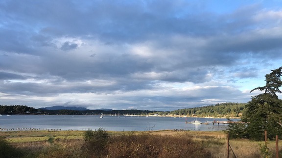
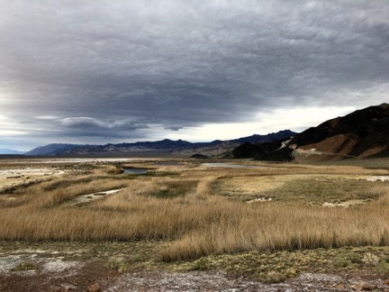
The view from my friend’s back porch. That’s Fishermans Bay.
In the morning when we met downstairs, I was kind of surprised to see that he had no interest in making or even eating breakfast together. He pulled out a drip coffee maker for me and made himself an espresso, which he drank with cereal. Not knowing what else to do — and definitely not interested in eating Cheerios — I found a frying pan and cooked up some onions and peppers with eggs I’d brought from my chickens. The peppers, from the outside fridge, were very cold. We’d later discover that the fridge was stuck on its coldest setting and everything in it froze, seriously limiting what could be done with the vegetables I’d brought from my garden. (We wound up throwing most of them away a few days later.)
By the time I joined him at the table, he was done eating. But he sat with me and we chatted, mostly about health care and politics. We pretty much agree on the current state of affairs, but not on how to handle it. I’ve voted and called senators and my congressman. I was active on Twitter to share factual information and fight fake news. But after trying too many times to talk reason to people who believed in fake news and conspiracy theories, I’d given up.
“You can’t reason with unreasonable people,” I said.
He didn’t agree. That made no sense to me. By definition, an unreasonable person is someone who won’t listen to reason. No?
He said that I needed to convince them without relying on truth and logic. Huh?
He said I needed to appeal to their emotions. Okay, but how can I do that without backing it up with facts?
He said I needed to keep trying, but he refused to explain exactly what I should do. And he never did tell me what he was doing other than continuing to try to get a job in the healthcare industry where he thought he could really make a difference.
The conversation went on longer than it needed to with nothing but frustration for me. It eventually shifted to healthy eating and fitness. My friend is very physically fit for his age. He routinely does long, strenuous hikes, sometimes with a backpack, up mountains. He does long bike trips, sometimes at high altitude destinations. And he seems to think not only that everyone can do what he does but that we all should. Walking isn’t enough. Even golfing without a cart isn’t enough. We need to do strenuous hikes or jog or run and we definitely need to go to the gym. All of us.
I’m probably a lot more active than the average woman my age. I hike and do some biking. I do all my own yard work: lawn mowing, gardening, tree planting, and pruning. Hell, I’ve had days when my iPhone reported I’d walked more than 10,000 steps without even leaving my property. I build things — sometimes very heavy things — and move them around as needed. I don’t do long, strenuous hikes or bike rides because I don’t want to. And working out in a gym is probably the most boring activity I can imagine. I don’t see how any of these activities can make my life better. All I can see them doing is reducing the amount of time I already spend on the activities I find rewarding: gardening, building things, spending time with friends, and traveling. So I’m really not interested in being lectured about how I should be doing more activities I don’t enjoy. Yet that’s what I was getting: a lecture. At breakfast. From someone who had just eaten a bowl of Cheerios.
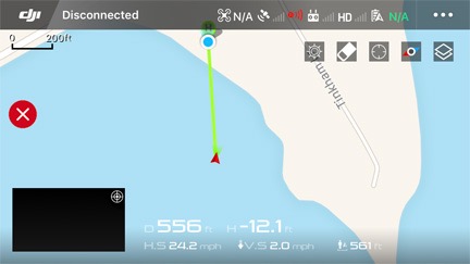
We cleaned up the breakfast dishes. He went upstairs to check email. He was expecting to hear from recruiters about a job he hoped to get an interview for. I took my drone outside. I flew it out over Fisherman’s Bay, capturing some really nice photos of the area. After about 10 minutes, I used the Return to Home feature to bring it back even though it was only about 550 feet away and I could have manually flown it in. Instead of climbing, coming back, and landing at its starting point — as it has every single time I’ve used that feature — it descended right into the bay.

In case you’re wondering, this is what the DJI app might look like just after your drone has descended into a body of water, never to be seen again.
So yeah, I lost my drone.
We took the boat out a while later to try to find it. But it had descended into water too deep to see into. Gone.
The good news for him was that he got a telephone interview scheduled for the next day.
Activities
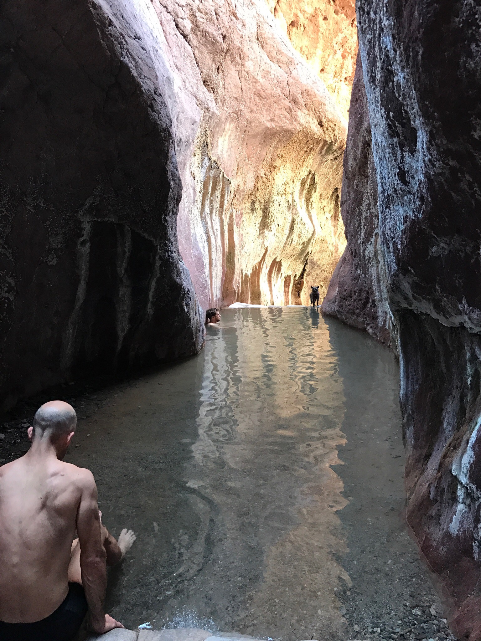
We did a few short hikes with the pretense of looking for edible mushrooms we never found. Too early the season? Not wet enough? Who knows? Lopez has some nice places to hike, none of which are very strenuous. That’s not to say that I didn’t need to stop and rest on uphill segments — I’ve always needed to rest periodically when hiking uphill.
We cooked the prime rib. It was excellent with some baked potatoes from my garden and acorn squash.
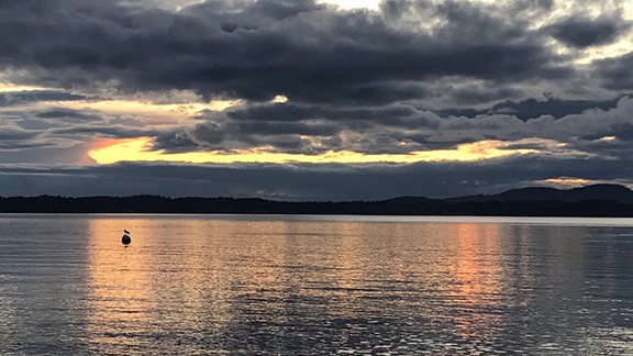
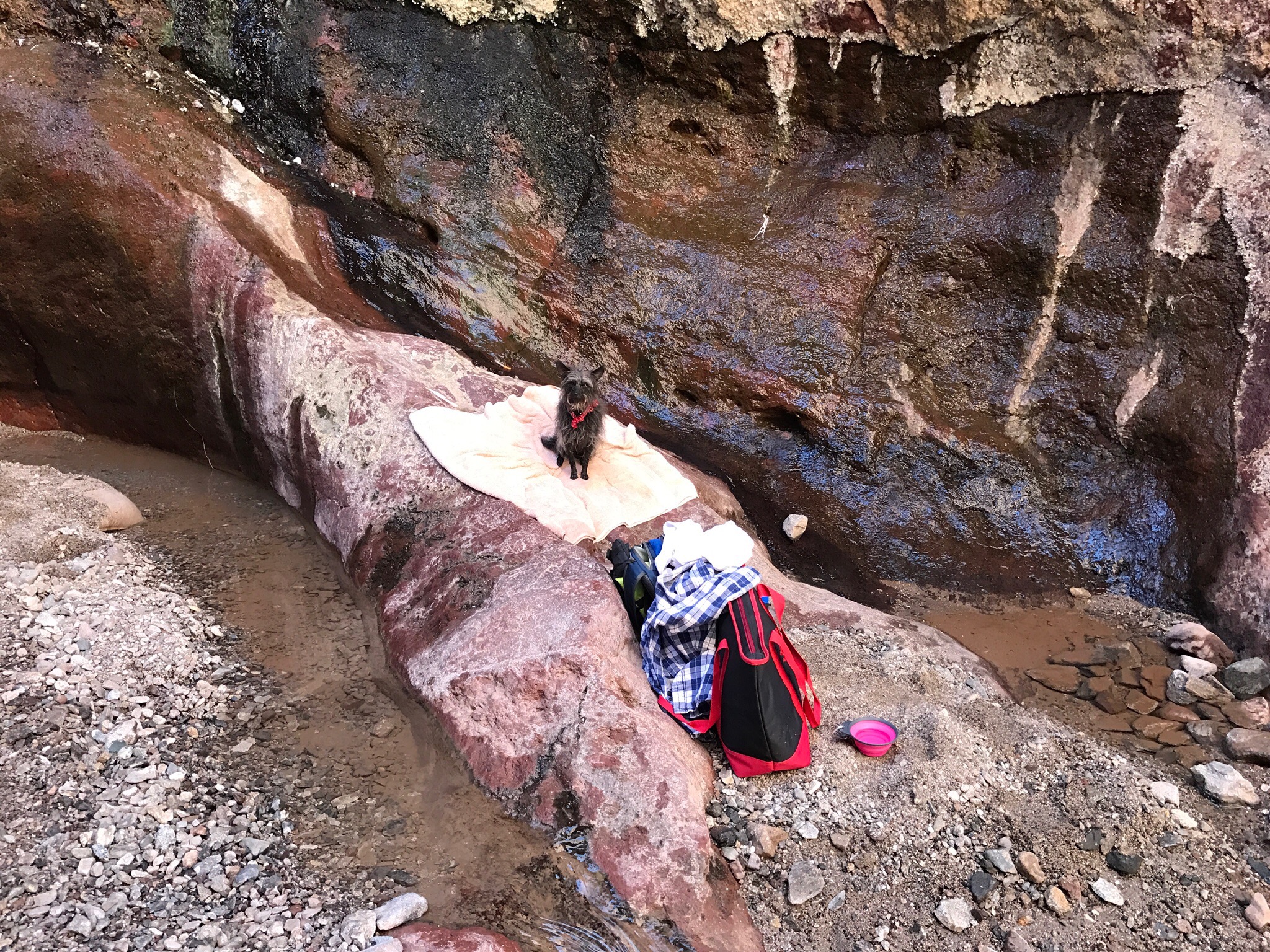
We walked out to watch the sun set but got to the beach too late. We walked around a little. Penny ran on the beach; she really likes it.
We were a little late for this sunset, but it was still nice.
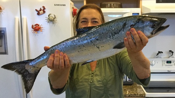
We went fishing on two days and were out most of the day. We caught one salmon the first day and another on the second. We hooked others that we lost.
This is me (with hat hair) holding up the 26-inch Chinook salmon I caught the second day out. I’ve since eaten half and frozen the other half.
We went to a few stores in town to pick up groceries and/or check the stock of the cider he sold there. I paid for everything we bought, mostly because I was getting a free trip to Lopez and he was unemployed. It made sense. When he tried to pay for something, I wouldn’t let him do it. I reminded him that I wasn’t paying for gas for his boat.
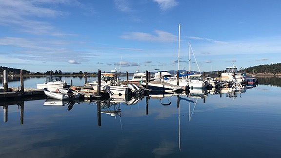
My friend’s house is on Fishermans Bay, which was glassy calm one day. He keeps his boat at a marina less than a mile from the house.
He had his job interview on Tuesday afternoon. It went well. So well that for a while, he was the guy I remembered meeting three years before. He had an in-person interview scheduled for the following week. Yesterday. I wonder how he did.
Echoes of another Man
I should make a side note here. Other than a seasonal job I had at the Grand Canyon back in 2004 flying for Papillon, I have not had a “real job” since 1990 when I began my freelance career. Since then, I’ve worked a number of hourly or per diem jobs for clients teaching people how to use computers, wrote 85 (or so) books and hundreds of articles mostly about using computers, was a landlord, operated an airport FBO, launched a helicopter tour and charter operation, and acted as an Airbnb host. Hell, I even drove for Uber for a while. I’ve made a good living with this combination of activities. Nowadays, I make most of my living doing agricultural work with my helicopter where I live and in California. I’ve learned how to turn skills and assets into money without relying on an employer. The reward: a decent income and plenty of free time to do the things I enjoy doing.
I’m a firm believer that anyone with a decent brain and good work ethic can do the same. It’s all about the ability and desire to work hard and smart. So when I’m with someone who is capable and apparently willing to work hard and smart yet struggles to find an employer in a job market that doesn’t favor the 50+ crowd, I’m surprised — especially when that person already has a side business that can be expanded to possibly meet his financial needs.
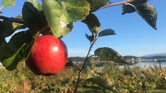
My friend has a small apple orchard on his property where he grows a variety of apples suitable for making hard cider.
Of course, this can’t help but remind me of my wasband. In the last few years of our relationship, he bounced from one job to another, never quite making any of them work for him. He was passed over for promotion at least once and taken advantage of several times. Yet every time he was unemployed, he’d go back for more, finding yet another employer in another job that he wound up hating. The crazy thing is, he had other things he wanted to do and I was certainly earning enough to cover expenses for both of us while he worked on building a business. I even gave him a do-nothing (or almost nothing) job at the airport paying him $20/hour (when my other guys were making $10/hour) so he’d have some income while he worked on those other things. But the one time he tried to launch a business on his own, he gave up long before he could possibly expect to succeed. And he never put any energy into the things he wanted to do: inventing, being an airplane flight instructor, designing a “plug and play” solar setup. The really crazy thing about this is that very early on in our relationship, he gave me the advice I’d learn to live by: if you want something badly enough, you have to make it happen.
I made it happen; he didn’t.
So my Lopez friend reminded me very much of my wasband. That might have been what originally attracted me to him — after all, my wasband had once been my soulmate. We were completing each other’s sentences only a week after we met. We did and liked all the same things. We basically became adults together.
But like my wasband, my Lopez friend had changed over the years. When we first met and did a few things together, we got along very well. But over the course of the three years since we’d had our first Lopez trip together, he’d changed. I honestly think his job situation had a lot to do with it — as I believe my wasband’s job situation changed him. I think it put him on the defensive and made him feel as if he needed to justify his decisions. What he said was right, what anyone else advised that differed was wrong.
To be fair, I’ve changed, too. Once my divorce was finally over — my assets stayed in my possession, my wasband finally paid me the money he owed me, we sold the last piece of property we owned together — and my life was rebuilt with a new home, new friends, and a bigger, more profitable flying business, I became happier and more confident. I began to really embrace life on my own, without the need to make someone else happy all the time. Without having to feel guilty for enjoying my life while my partner remained miserable in the rut he’d dug for himself. I was done pretending to be someone I wasn’t to score points with other people. I was true to myself and usually said what was on my mind when I was with people I cared about.
And it was that person I’d brought to Lopez Island last week: mature, independent, relaxed, confident, honest, open.
And that person quickly lost patience with the confrontational tone of conversations she was having with her host.
Let the Mansplaining Begin
I’m amazed in this day and age that not everyone has heard the word mansplaining, yet over the past few days, I’ve found myself defining it for others. Here’s what Wikipedia says about it:
Mansplaining is a portmanteau of the word man and the informal form splaining of the verb explaining and means “to explain something to someone, characteristically by a man to woman, in a manner regarded as condescending or patronizing.” Lily Rothman of The Atlantic defines it as “explaining without regard to the fact that the explainee knows more than the explainer, often done by a man to a woman,” and feminist author and essayist Rebecca Solnit ascribes the phenomenon to a combination of “overconfidence and cluelessness.”
The version of mansplaining I was subjected to during my Lopez stay was the sort where the explainer — my host — assumed I knew absolutely nothing about what he was telling me. When I asked him questions — for example, about testing apple sugar content for cider — he’d get annoyed and say something like, “If you give me a chance, I’ll tell you.” Then he’d start with the very basics which I often already knew and lecture me until he was done, often not answering my original questions.
When we went fishing on his boat — which, by the way, I liked a lot — he treated me as if I’d never boated or fished, despite the fact that I told him I’d been boating and fishing since childhood and actually owned a boat. Rather than let me help on the boat when help was needed, he’d make a point of telling me I was in his way or to sit still. Then when he was worried about docking at Friday Harbor, he instructed me to help tie up the boat by making a sort of loop with the line and lassoing the dock cleat — when in fact it would have been much easier for him to fasten the line to the boat cleat and let me jump out with the other end. I grew up with boats; don’t you think I know how to tie one up?

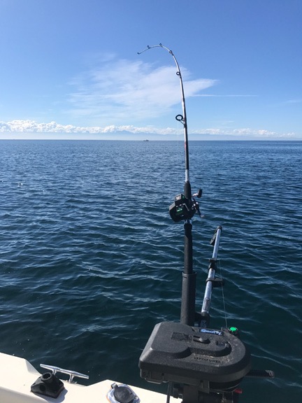
One of the two downrigger setups on my friend’s boat. A weight on the downrigger pulls the fishing line from the pole to the desired depth and keeps it there while trolling. When the fish pulls the line, it breaks loose from the downrigger weight and the fun begins. This is a pretty common setup for salmon fishing in the Pacific Northwest.
He seemed to think I wasn’t capable of doing anything without his instructions — and his instructions were often so over simplified that I wondered whether he thought I was an imbecile. It wasn’t until our second day out on the boat that he finally agreed to show me how to use the downrigger, a simple device I’d never used but picked up quickly. Then, when I asked him whether he needed to stop the boat so I could check my line for weeds, he asked whether I wanted it to be easy or hard. I told him I wanted to do it without tangling the line in the engine as we had the first day, when he’d let the line out while the boat was idling. The way I saw it, that meant continuing on course. Since he didn’t specify that the boat needed to be stopped, I just pulled my line in, worked the downrigger, removed the weeds, and had it all back in the water for trolling in less than five minutes. Seriously: it was a simple device.
It was very hard not to snap at him, but I tried. After all, he was my host and manners required me to cut him a lot of slack. But at one point, his mansplaining got so annoying that I told him point blank to stop talking to me as if I was an idiot.
Yet on the same boat trip, when we were communicating like adults of equal intelligence — which I’m pretty sure we are — he admitted several times that I was verbalizing exactly what he was thinking. It was like my early days with my wasband all over again. It made me sad because I knew there would be no relationship with this man.
The End
I can go on and on about little things that really got under my skin — the more I think about it, the more I remember — but I’ll limit myself to two more.
First, during a discussion of work and careers, I admitted that none of my three careers was really my “dream job.” I’d always wanted to be a novelist and although I did have a very good career as a writer for about 20 years, I wrote tech books and not novels. Even the flying I did wasn’t exactly what I wanted to be doing every day but it paid very well and gave me lots of free time. He countered my admission with “I’d never do a job I didn’t like for pay.” Huh? Well, I guess that’s one reason why he’s unemployed.
And yes his insinuation that I had “sold out” by settling for something other than my dream job did really get under my skin. But that’s my problem; I don’t think he intended his comment as an insult.
The other had to do with something that happened after he assured me so many times how considerate he was toward other people. The porch light might bother neighbors. Flying a drone in a public place might bother people around him. Comments like that. Yet on our return to his dock slip after our second day of fishing, he drove the boat past a marina fast enough to create a considerable wake. A man on a boat there called out, “Do you really need to go that fast here?” When I passed this question on to my friend, his response was something like “tough luck” and he maintained speed. He seemed to resent that the man had a bigger boat. How is that considerate for other people? Seems like hypocrisy to me.
I know I’m not perfect and I’m sure folks could come up with lists of things like this that I do. Sometimes I wish they would. I know I wish my wasband would have. Instead, he kept his list of pet peeves shut up inside his head, allowing it to stew until it turned into a hatred for me. How does that help anyone?
During our few conversations early in the week, my friend accused me of trying to one-up him every time we spoke. He’d tell a story and I’d tell a related story. That’s how conversations work. But apparently he saw it as a competition of sorts, even though that’s not what I intended. I solved the problem by not starting conversations and keeping my stories to myself. Honestly, I was afraid to talk, afraid to give him anything he might use as ammunition to start an argument. He had become adept at turning a simple comment into a personal affront. It made for a lot of quiet, tense moments together, especially on the long car ride early Friday morning from Anacortes back to his home and my car. (And no, this time I didn’t stay in the car for the ferry ride.)
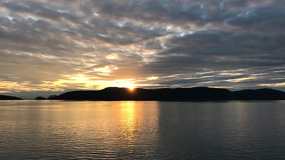
Dawn from the ferry on Friday morning.
Our goodbyes weren’t warm. He said, “We have a lot in common but we also seem to do things that annoy each other.”
“That sums it up perfectly,” I responded. He seemed surprised — maybe because I agreed with him?
But I know I’ll never be invited back to Lopez Island and I also know that if I was, I wouldn’t go.
And it looks like I’ll need to find a new wine tasting partner. He never did open the 13-year-old bottle of wine he claimed he was saving for me.
What I Learned
I learn something every day and I learned a lot that week at Lopez.
I learned that I can get a lot more into my S2000 than I thought. I was also reminded how much I like to drive it.
I learned never to trust the Mavic Pro software to land a drone properly, no matter how many times it’s done it properly in the past.
I learned how to use a downrigger and that salmon really do need constant tension on the line when the hook has no barb.
I learned that I enjoy doing things on my own a hell of a lot more than with an insecure, confrontational companion, no matter how much we have in common. (Of course, I already knew that based on the last few years of my marriage and the brief time I dated another smart, insecure man back in 2015.)
I learned that most men — even smart men — can’t help putting smart, independent women in their place whenever possible. They feel threatened by us somehow. They can’t admit that we might be intellectual equals so they fight back by belittling us as much as possible. Hence, the mansplaining.
But the most important thing I learned is that I don’t want to wait until retirement to live on the water. I really do like being on the water.
I think about all the years I waited for my wasband to get his head out of his butt and start enjoying life and it makes me angry. Those were wasted years. I don’t have to wait anymore. I can live all of my dreams now, before I get too old to enjoy them.
That said, I’ve come up with the seeds of a plan to live on the water during my off season time. My friend’s boat was a C-Dory Classic 22 Cruiser, which was a lot like my little truck camper, as far as comfort features are concerned. It had a closed in cabin, bed, dining table, refrigerator, sink, stove. The only thing it lacked was a head (bathroom). The C-Dory Classic 25 Cruiser or C-Dory Venture 26 has all that plus a head. It’s seaworthy, perfect for fishing, and not bad for traveling, especially in the islands close to shore. I could see replacing my silly little jet boat and camper with something more substantial and taking long trips in the San Juans, Inside Passage, and even Lake Powell and the Intercostal Waterway on the east coast. A boat like that can be my vacation home, with a trailer to pull it anywhere I want to launch from.
While the boat isn’t in my immediate future — I’m thinking 2020 — I can start doing interesting trips on my own sooner. I worked Google like a pro when I got home and found all kinds of interesting adventures. I’m considering this trip to learn how to navigate the Inside Passage and this trip for herding sheep on horseback in Iceland. These are not boring package tours for seniors. These are trips when I can learn and do new things, building on skills and knowledge I already have. Trips where I’ll be among a handful of like-minded people instead of hundreds or thousands of tourists checking off destinations on a bucket list.
Because to me, that’s what life is all about: learning and doing new things, meeting new people, making every day different from the one before it.
Yes, it’s true: I don’t have my dream job. But I’ve got no real complaints about the jobs I have, especially since they give me the time and money I need to do the things I want to when I’m not working.