A three-day journey, part solo, part with a companion.
Earlier this month, I got an offer I couldn’t refuse: a fellow pilot — Skyler, based in Los Angeles — wanted to lease my helicopter for two months so a client of his could experience what it was like to own a helicopter. The terms were set and they were good for both parties. My helicopter was probably going to sit in its hangar until the beginning of May anyway. Why not get it out early and let it earn some money for me?
So I did the necessary paperwork with my insurance company and Skyler’s client. Part of the deal was that I’d get the helicopter an annual inspection before delivering it in Los Angeles — even though that could have waited until the return flight in May. Because the client would cover that expense, was I going to say no? Of course not. So on the Ides of March, I pulled it out of the hangar, started it up, and went south.
Wenatchee to McMinnville
Or I would have. Instead, I pulled it out of the hangar, tried to get it started, failed, put it on a battery charger, waited two hours, tried to start it, failed, put it back on a battery charger, ordered pizza for the maintenance guys, had lunch, tried to start it, and finally succeeded. Three hours after I’d expected to leave, I finally took off. It was 1 PM.

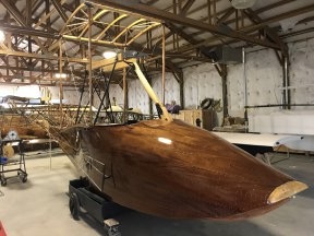
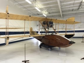
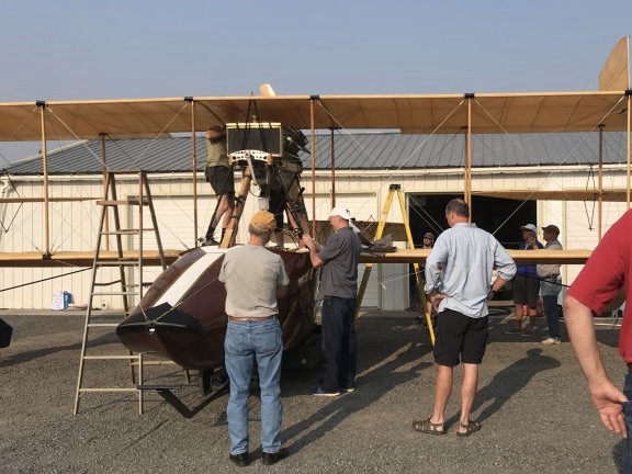
Here’s Mr Bleu in Wenatchee, tethered to the ground by a battery charger cable.
(And before anyone freaks out about me flying a helicopter with a less-than-pristine battery, have you never jump-started a car? And, if you’ve done so, has the engine ever failed after you started it? This is the same thing, folks. The helicopter’s alternator charges the battery in flight, just like your car’s alternator does for its battery when you drive. You only need the battery when you start it or if the alternator fails. And even then, the engine won’t quit.)
Interested in seeing the cockpit POV video from last year’s trip to McMinnville? It’s in five parts because of all the weather I had to deal with:
The last two have the most weather, if you like watching an idiot in a helicopter running the scud.
The flight to McMinnville, OR, where my mechanic is based, was a lot better than it was last year, as documented in a series of videos on Flying M Air’s YouTube channel. I actually had decent weather — even some sun! — for most of the way. It got a little iffy just before reaching the Columbia River near Cascade Locks, and the wind was howling just before I got there, but once I settled in over the Columbia a trip down the lower gorge, things settled down. I was glad I’d chosen the route I’d picked, which was pretty much a straight shot from Wenatchee to Hood River (modified in flight to Cascade Locks to avoid wind in the gorge), down the river a bit, and then straight to McMinnville. A pilot friend had suggested following I-90 across Snoqualmie Pass to the Seattle side of the mountains and then south along I-5 — a real IFR (I follow roads) route — and that may work for him, but I’ve always had bad luck trying to cross the Cascades there. On this particular day, I definitely made the right decision since there were low clouds west of my route, possibly along the route he’d advised. Flying anywhere west of where I live in late winter or early spring is always a crap shoot and I’m sick of playing craps while I fly.
While on that topic, I should mention that I’m pretty sick of flying in bad weather, period. My helicopter had, at the time of my departure, only 86 hours left until overhaul. I’d fully expected to get it overhauled last year, but 86 hours is definitely enough for another cherry season, as long as I don’t fly it for fun and run down that clock. So I put it away for the winter. That means that 90% of the time I’m flying is either down to McMinnville and back or during/after rain where I live. Flying in rain may keep the blades clean, but it sure isn’t as much fun as flying on a perfectly clear, windless day.

Here’s the route I wound up taking. I originally aimed for Hood River, but revised my route to cut the corner and (hopefully avoid some wind) when I got just past the fire tower.
So this flight was relatively uneventful. I’ll post a video when I get around to it. I’ve already posted a video with clips about a fire tower I flew over. Although folks claim they like my long videos, I just don’t understand why. They get boring after a while — even for me, and I’m doing the flying.

I made a whole video about this fire tower. And yes, that’s Mt. Adams off to the right.
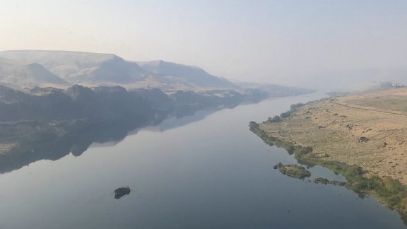
While I normally follow the river closely when I’m in the Columbia River Gorge area, I was eager to get to my destination without wasting a lot of time, so I flew straight lines whenever I could. That put me in a unique viewpoint for the Bonneville Dam, which was kind of cool. For some reason, however, I missed a bunch of the waterfalls on the Oregon side that I usually see — are they above Cascade Locks? If I weren’t so darn lazy this morning, I’d check a map. It could also have been the low clouds distracting me.

Here’s a different perspective of the Bonneville Dam, approaching it from a peninsula into the Columbia River just upstream from there.
I crossed into Oregon just east of Troutdale’s airspace. Along the way, I caught sight of a message for our previous president that someone had planted in their yard. The weather was drizzly, but I had no need to make any detours. I landed at McMinnville almost exactly two hours after I’d departed Wenatchee.

This gave me a good laugh as made my way southwest across the northwestern part of Oregon.
At McMinnville
I blogged a bit about my travels earlier this week, so I’ll try not to repeat what I said there.
The short version is, I knew it would take at least a day and a half to do the annual inspection on my helicopter. Jerry Trimble Helicopters, where I go, is kind enough to provide courtesy cars for customers, so I climbed aboard a low-end Nissan — I’d gotten a brand new Volkswagen sedan on my previous trip — and set about finding a hotel and some food. I settled in at a Comfort Inn with some groceries for dinner.
On my full day in the area, I visited the Evergreen Aviation Museum, which is right across the street from the airport where my helicopter was being worked on. It was great touring the place with a docent all to myself and hardly anyone else around. I highly recommend it. (You know the Spruce Goose is there, right?)

How often do you get to see an SR-71 Blackbird from the top? This was on the “behind-the-scenes” part of my docent-led tour.
I checked in on my helicopter before heading into town. It looked as if the crew was just past halfway done. The had to replace a hose because of a service bulletin but everything else was looking good. The battery was on a charger. They didn’t have a replacement and I couldn’t wait for them to get one, so I hoped it would be okay. If not, Skyler could get it replaced in Los Angeles. I was confident that it would start the helicopter on the remaining days of my trip south.
I went into town, where I had a wine tasting (and, like an idiot, bought three bottles of wine) and then ate dinner outdoors at a South American restaurant. Then back to the hotel, where I put together that fire tower video mentioned above.
In the morning, I had to figure out how to get the wine I’d foolishly bought home. I’d be flying to Los Angeles in the helicopter, but from there I needed to get on an airliner to get home. I had two carryon bags and was not interested in checking either one. The wine, even in a box, would put me over the limit. So I set about finding a place that could ship it for me. There are restrictions on shipping alcohol — who knew? — and a few hurdles to jump. But after parting with nearly as much money as it cost to buy those three bottles, they were in someone else’s hands. (They arrived at my house yesterday.)
At the Jerry Trimble Helicopters hangar, I saw what’s left of Robinson R44 Raven I N45PG. Back in 2003, this helicopter belonged to my friend Tristan, who had big plans to build a business with it. As a CFI, he gave me my R44 transition training in this ship and I leased it from him for three months in 2004 to see if I wanted to get my own. Seeing it in pieces, needing a ton of work to get back into the air again, was bittersweet. I have a photo of it somewhere; I’ll share it if I find it. Tristan, who has an even shorter attention span than I do, is on to other things.
Back to the airport to check on the helicopter and set up the cameras for the next part of the flight. Would it be done by 2 PM? Skyler was arriving at Portland on a 1:30 PM flight and I had to pick him up. Ideally, the helicopter would be sitting on the ramp ready to go when we got back. It looked good. I left.
It was an hour drive to the airport. I arrived about 5 minutes before Skyler’s flight landed. I was waiting at the curb when he came out. We made the hour drive back, stopping at a DQ for lunch in the car along the way.
It wasn’t ready when we got back, although it was outside the hangar. Panels were still off and the battery was missing. The mechanics were kind of swarming around it like a pit crew at a race, but not moving nearly as fast. No one should rush maintenance.
Skyler and I loaded our luggage in back as the guys worked. A fuel truck came and topped the helicopter’s tanks. I paid the bill; I’d be reimbursed the next day.
It was after 3 PM when I did a quick check flight with Jerry. We talked a little about the “hop” in the rotor blades. It could be smoother with a blade balancing, but I didn’t want to spend the money on one so close to overhaul. He didn’t think it was so bad. I was used to it.
Finally, Skyler climbed in and we took off.
McMinnville to Susanville

Here’s the second day’s route. It would have been a straighter line if we could have gotten fuel at Klamath Falls.
I’d planned a very boring route down California’s Central Valley, keeping in mind that the winds were forecasted to hit 60 mph the next day at Weed so we needed to be past there by nightfall.
But Skyler had a different idea. He wanted to take a direct route that would have us on the east side of the lower Cascades and then crossing the Sierra Nevada on a diagonal the next day. I was game to try, mostly because I knew the wind would be less severe on the east side. So we headed south with the wishful thought of stopping at Tahoe for the night.
We flew over a whole lot of nothing. After leaving the valley and getting into the foothills of the lower Cascades, it was just snow-covered forest — much of it logged and replanted — and a lot of snow-covered back roads. There was one interesting spot where dead fir trees — possibly killed in a fire? — cast long, horizontal shadows on the bright white hillsides. The effect was stunning. (I’d share a photo but, true to form, the camera that would have caught it crapped out on me not long after departing McMinnville.)
Our flight path, aiming for fuel at Klamath Falls, had us on a direct path over Crater Lake, which I’d never flown over. The view of the seasonally closed park was stunning. I started heading out directly over the lake but changed course when I realized that an engine failure over the middle of the lake would have us freezing to death in cold water before we could get to shore. I changed course and hugged the northeast shore, getting back on course on the other side.

I flew over Crater Lake while Skyler played tourist. I erroneously thought that my helicopter’s nose cam would pick up footage from our flight, but the damn thing had stopped writing to the video card 15 minutes after leaving McMinnville.
We arrived at Klamath Falls at 5:15 PM. We tried calling the FBO from the ramp, but there was no answer. Skyler walked to the FBO office while I shut down. He returned, cursing. Although they were still in there, they wanted an extra $150 to fuel us because it was “after hours.” Neither of us wanted to pay, so I started up and we continued to the tiny rural airport at Malin just 18 NM away. We used self-serve to put in the maximum allowed — can you believe the pump had a shut off? — which would be enough to get us to Tahoe.
But by this point, it was getting late. We were another hour into the flight when we started doing math. Sunset was just after 7 PM but it didn’t look as if we could make it to Tahoe until well after 8 PM. Neither of us wanted to fly over the mountains in the dark. Where could we stop for the night?
Skyler flew while I worked Foreflight on my iPad. By some miracle, we still had a cell signal. After a few discarded suggestions, I looked at Susanville. The town was about 5 miles from the airport. It would work if we could get ground transportation.
I picked up my phone and called the number for the FBO. Second miracle: someone answered.
I asked if they had a courtesy car for two helicopter pilots who needed to spend the night in town. After a moment of hesitation, the man promised a Crown Victoria (third miracle!), told us where to park, and asked when we’d be leaving in the morning. I told him we’d leave after 8 AM and we needed both fuel tanks topped off before going. He gave me another phone number if I had questions and we hung up.
We arrived in Susanville just before sunset. We parked where a guy on the radio — the same guy? — told us to, unloaded our luggage and my cameras, and walked to the terminal where two men chatted with us. One of them offered us a beer several times — I think he wanted us to hang out. But we where exhausted and declined. Instead, we climbed into the car and headed for town.
It was the Red Lion for our overnight stay, with a stop at the KFC across the street for dinner. I spent the evening transferring video files from my cameras to a hard disk and trying to troubleshoot the problem I was having with my relatively new GoPro Hero 8.
Ah, the glamour of cross-country flight!
Susanville to Los Angeles

This turned out to be our route on Day 3. We didn’t really use waypoints at all; the idea was to get around the mountains and then head into the Los Angeles area.
It was overcast the next morning. And cold.
We stopped at a Starbucks for coffee and breakfast and then headed to the airport. They’d filled the helicopter with fuel; Skyler’s client picked up the tab (again, as he would for the whole trip). We chatted with a bunch of guys and a kid in the terminal, including a guy who did a UPS package run across the mountains in his King Air every day. He told us that the conditions were bad where he had come from, which I think may have been Redding.
We discussed our route. Skyler wanted to continue on his original route. I was concerned with mountain obscuration in the Sierra Nevada and the possibility of high winds up in the mountains. The way I saw it, we needed to pick a side of that range: east or west. If west, we should move back to the west side before going further south, although that could put us in the weather the King Air pilot had mentioned. If east, we’d be fine flying past Reno and then dropping into the Owens Valley. We could head west when we got to the desert.
He chose east so we took off to the southeast.
The trip started off a little bumpy with winds and mechanical turbulence. The rule when flying a Robinson in wind is to slow down — keep it below 100 knots. That isn’t so tough given that my ship doesn’t cruise much faster than 110 knots in the best conditions. Skyler did a bunch of flying; he likes to experiment with the way the wind affects the helicopter when flying near mountains. I just wanted a smooth ride. I don’t know too many people who don’t hate turbulence.
The weather settled down by the time we got near Reno. We crossed the metro area on the west side, in the foothills. We continued south. Through more snow-covered, hilly, forested terrain. It was beautiful but kind of monotonous.

Skyler flew past Reno while I took pictures out his side of the cockpit bubble.
Skyler suggested we stop for lunch at Lake Tahoe. I was game. I was hoping for some decent footage from the nosecam, which was now using one of my GoPro Hero 7s. He flew, trying hard to get some “cinematic” footage along the way. We came through the mountains at a pass; there were low clouds misting rain or snow over the lake, so we had to stay pretty low. It was about as gorgeous as you might expect.

Flying low level down the east shore of Lake Tahoe. I’m not sure, but I think my camera had something on the lens dead center; it doesn’t seem properly focused.
We came in for landing at the airport there and put in a fuel order. He had some paperwork to do for the insurance so he used the computer in the FBO. Afterwards, we went to the restaurant in the building next door. We ate indoors — it was chilly out on the patio — but there were only a few other people in there so I felt safe enough.
After lunch, we climbed back on board and continued the flight. We’d considered hopping over to the Central Valley by way of Echo Pass, but had decided to stay on the more interesting side of the mountains. (If you’ve ever flown in California’s Central Valley, you know what I mean.) The ceilings were kind of low, but not low enough to be a nuisance. Still, I was interested in following a known path that would go through the mountains without having to climb over them. So we headed southeast until we found Route 395 and followed it south.

We crossed this valley on the way to intersect with Route 395. I wanted to avoid having to fly over peaks like the ones in the distance; better to follow a road and fly through the passes.
Eventually, we got to Mono Lake and the town of Lee Vining. After that would be Mammoth Lake and beyond that, at around Bishop, the terrain would finally descend and flatten out into the Owens Valley. All along the way, we’d have the towering, snow-capped Sierra Nevada Mountains on our right with lesser mountain ranges off in the distance on our left.

Skyler flew low over Mono Lake, giving us a view of the tufa formations on the northwest shore.
I flew for a while when the terrain got too boring for Skyler. Past Bishop, I overflew the radio telescope installation, being careful not to directly overfly any of the telescopes in case they were working. I remembered the installation being a lot bigger than it was that day but chalked it up to remembering a time when I felt smaller and the world around me when I flew seemed so much bigger. For a while, I settled down over the Owens River, flying a staight line as it snaked back and for the beneath us. Then I moved out over the divided highway of Route 395, remembering that I’d driven that road only a month before on my way home from Death Valley and my other winter travels.

Route 395, somewhere in the Owens Valley.
It was around 2 PM when we stopped for fuel at Lone Pine. It was self serve and Skyler did the filing job while I handled the ladder and grounding strap. He debated whether he should put fuel in both tanks but decided not to; our original destination airport — Brackett Field, I think — charges a landing fee if you don’t put on at least 30 gallons. He wanted to come in nearly empty. (It actually turned out to be a bad decision because we didn’t have enough fuel to get there with sufficient reserves.)

There wasn’t much going on at Lone Pine Airport on that Thursday afternoon.
Before continuing south, I ducked behind the helicopter, stripped off my turtleneck, and put on a t-shirt. We’d gone from frigid air to desert heat in just a few hours. I climbed back on board, started up, turned on the air conditioning, and headed out. I don’t know about Skyler, but I was ready to be done flying.
But we still had miles to cover. We passed Owens Lake on the west side and continued down the valley. Eventually, we crossed over some hills, heading toward Isabella Lake. Then down through Kelso Valley. Through one wind farm and then another. Past many solar installations across the high desert north of the mountains north of Los Angeles.
By then, Skyler had decided that we needed fuel. He headed toward Whiteman. I didn’t see the airport until we were nearly on top of it — it’s completely surrounded by roads, businesses, and homes.
By this point, I was a passenger and was enjoying it. I have very little experience with the crowded Los Angeles airspace and no desire to expand my knowledge. Skyler knew it well; he could fly and talk. In fact, when we left Whiteman, we switched seats and I settled back with my phone to be a tourist.
He offered me two quick tours of the Los Angeles area: The coastal route with celebrity homes or downtown LA. I picked downtown, never dreaming that he would get so close to downtown. But before we got there, we went past Universal Studios, the Hollywood sign, and Dodgers Stadium, which was a COVID vaccine site filled with cars. Downtown Los Angeles had more helipads than I thought possible; Skyler told me that every building over 13 floors has one for emergencies.

Downtown Los Angeles, up close and personal from the air.
From downtown, we headed for his revised destination — he’d been chatting occasionally via text with his client since leaving Tahoe — Hawthorne Municipal Airport, home of SpaceX. He landed on the runway and followed the tower’s instructions to set down at the FBO. We touched down at 5 PM, exactly the time he’s told his client we would arrive. He hurried inside to meet the client while I unpacked my luggage, made a Hobbs book entry, retrieved my cameras and most of my mounts, and said goodbye to Mr Bleu.
I got to meet the client, Chris, inside the FBO. He was heading out with Skyler; they’d do a tour of the area as soon as he got clearance from the tower to depart.
I got a video of them taking off.

Here’s Skyler and Chris taking off from Hawthorne in Mr Bleu.
Left alone in the FBO, I organized my things and worked Google to make a hotel reservation. I’d be in the area until Saturday morning and, without a car, would be Ubering here and there. I was gone before they returned.
Afterword
I collected a lot of video during the trip and a lot of it will get edited for Flying M Air’s YouTube channel over the coming months. My cameras, of course, did not all behave so I don’t have complete footage of the flights from any one position on the helicopter. But that’s okay. I’ll make the best that I can from what I have.
Mr Bleu will be returning before May 15. I won’t be flying him back. Skyler and Chris plan to do the trip over four days. I’m bummed out, but can’t complain. They’ll be paying for that entire flight so it’s all good.
And who knows? They might fly Mr Bleu again in the future.